DC: Scattered storms late today could be severe
Scattered storms late today could be severe
https://www.capitalweather.com/live/#sc
By Jason Samenow
Published: Today, 9:59 am
Last updated: Today, 2:36 pm
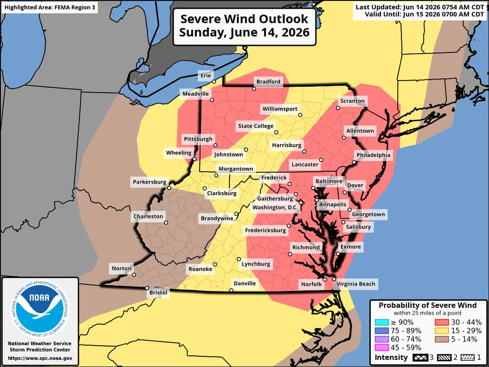
Map showing Mid-Atlantic region in area with an elevated chance of damaging thunderstorm winds Sunday.
The National Weather Service indicates there is 30 to 44 percent chance of damaging thunderstorm wind gusts within 25 miles of any location in the red-shaded area.
Sticky, steamy air has returned to the DC region, setting the stage for the possibility of strong to severe storms late this afternoon and especially this evening.
Storms that develop could produce damaging winds, hail, heavy rain, and frequent lightning. There is also an outside chance of an isolated tornado with the most intense storms. Peak wind gusts could reach 60 to 70 mph, toppling trees and causing power outages.
Storms will probably be most numerous along and especially east of the Interstate 95 corridor toward the Chesapeake Bay and Eastern Shore. Coverage may be more limited to the west, but everyone in the region should stay alert and remain flexible with outdoor plans.
The most likely timing is from 5 to 11 p.m. region-wide, but more like 6 to 10 p.m. around the Beltway (earlier to the west and later to the east). Keep in mind that these windows are only approximate and could shift.
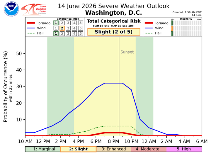
Chart showing most likely timing for storms in DC is between about 5 and 9 p.m. (National Weather Service)
{snip}
 = new reply since forum marked as read
